Get Around
Whether you walk, drive, cycle, or take public transportation, Moncton’s highways, roads, bike lanes, sidewalks, and trails make for easy commuting. Find out more about active transportation, parking, and driving in the city.
Active Transportation
Neighbourhood streets and trails make it easy to get around without relying on a vehicle. 80+ km of interconnected trails connect all parts of the city to the downtown.
Bike
Whether you are biking for fun or to commute, Moncton is an excellent city to cycle in. Interconnected trails and shared routes offer a safe, efficient and environmentally-friendly option for travel. Bike racks are located throughout the city and on all Codiac Transpo buses. For longer-term bike storage, bike lockers, managed by La Bikery, provide highly-safe, long-term storage of your cycling equipment.
Walk
Moncton is one of Atlantic Canada’s most walkable cities. Neighbourhoods offer a variety of parkland and streetscapes to walk along. An urban trail system connects all parts of the city to the downtown core. Most trails and sidewalks remain groomed in winter.
Transit
Codiac Transpo serves Moncton, Riverview, and Dieppe. Visit the Codiac Transpo website for information on schedules, routes, and fares.
New bike lanes in 2023
The City of Moncton is working to expand its cycling network as part of its Active Transportation Plan.
For 2023, new bike lanes were installed on Killam Drive, Vaughan Harvey Boulevard, and Dickson Boulevard, plus a new multi-purpose trail is being constructed connecting Riverfront Trail with the new bridge to Riverview.
The bike lanes on Killam Drive and Vaughan Harvey Boulevard are the first to have physical barriers between cyclists and drivers – creating a much safer space for cyclists on these busy streets.
The FAQ below answers some of the questions people are asking about the new bike lanes.
Bike lane FAQs
Why were bollards installed instead of painted lanes?
Physical separation on main roadways such as Killam and Vaughan Harvey is a recommendation from phase two of the Active Transportation Plan, which follows recommendations from the Transportation Association of Canada. These facilities are meant for all users, not just avid cyclists who would be comfortable riding on busier streets without a physical separation.
Why not have a completely separated trail?
Building a completely separated trail for cyclists usually requires relocating utility poles and fire hydrants, re-doing curbs, acquiring land, and so on – essentially a full street reconstruction. This type of project is much more expensive and more time consuming. Adding bollards or bolted curbs is a cost-efficient way to provide a physical separation between cyclists and vehicles until such time as streets undergo a full reconstruction.
How do I pull over for emergency vehicles or if stopped by the RCMP?
The section of Killam Drive that is equipped with bollards is approximately eight metres wide – the same width as many other streets in the city, so there is still enough room for emergency vehicles to get through if you pull over next to the bollards. The bollards are also spaced in such a way that there is room for a vehicle to pull over between them if necessary (while keeping an eye out for cyclists).
Vaughan Harvey Boulevard remains a four-lane roadway with a median. As is the case with any other street, motorists must pull to the outside lane (right-hand side along the bollards and curbs) to make way for emergency vehicles.
What happens to the bollards in the winter?
The bollards will be removed for the winter to allow for snow clearing up to the curb. Depending on the type of bollard, the holes in the pavement will be filled with caps or grout to protect the surface. The City is testing two types of bollards to determine which works best.
What should I do if I want to turn right and a cyclist is going straight at an intersection?
Motorists turning right must yield to a cyclist that is going straight at an intersection.
Why were bike lanes added to Killam Drive? They don’t connect to other parts of the cycling network.
The total cost to implement the recommendations from phase two of the Active Transportation Plan is about $200 million. This is a long-term plan. The infrastructure will be built in sections, and, to maximize what can be accomplished each year with the funding available, as well as to avoid re-doing work, the recommendations will be implemented mainly in coordination with the City’s street renewal program.
However, it is worth noting that the section of Killam Drive between Ayer Avenue and the roundabout connects to the Russ Howard multi-purpose trail, which provides access to many recreational facilities. Further south, it connects to Centennial Park and the Northwest Trail, which lead to downtown. This means that a large residential area (Ayer, Birchmount, Pinehurst, etc.) now has a safer means to access downtown and the recreational facilities along Russ Howard and at Centennial Park.
Parking

Driving
Moncton is an easy city to navigate. Several highways connect all areas of the city to the downtown core. There is also plenty of parking throughout the city. The driving experience changes with the seasons, be sure to check road conditions before venturing out.
Resources:
Accessing key destinations
Avenir Centre
Accessible options
Accessible parking: There are a number of accessible parking spots on Canada Street offered on a first-come, first-served basis.
Accessible drop-off: An accessible drop-off is located on Canada Street directly outside the Centre. Enter Canada Street from Vaughan Harvey Boulevard and follow the signs to the accessible drop-off. Exit onto Main Street.
Codiac Transpo: Codiac Transpo has nine wheelchair-accessible routes serving Moncton (#16, #50, #51, #60, #61, #62, #64, #65, #93). Buses along designated wheelchair-accessible routes are either equipped with one or two wheelchair spaces. Find out more about wheelchair-accessible transit on Codiac Transpo’s website and visit the schedules and routes page or use the Codiac Transpo app to plan your trip. If you need additional assistance, you can also contact Codiac Transpo weekdays from 8:30 a.m. to 4:30 p.m. at 506-857-2008.
Ability Transit: Wheelchair-accessible buses are available to citizens in the Greater Moncton area. Each bus is equipped with hydraulic lifts and tie-downs for passengers in wheelchairs, plus room for four seated passengers. Contact 506-853-3055 to book a trip.
Park and walk
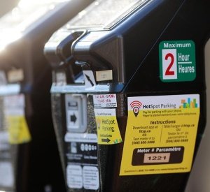
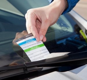
Visit the parking map to see where to find metered on-street parking and City-owned parking lots. There are also privately owned lots that offer event parking. Visit the Downtown Moncton Centre-Ville Inc. site for a list of privately owned lots.
On-street parking is free on weekends and holidays and after 6 p.m. on weeknights. Parking lots charge various fees for entry. City-owned parking lots have a flat fee of $3 between 6 p.m. and 6 a.m.
Car and taxi drop-off
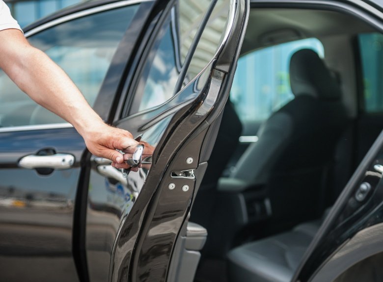
By car: There is a designated drop-off area for patrons along Cameron Street near Main Street – just one block away from the Avenir Centre.
By taxi: There is a designated taxi drop-off and pick-up location on Highfield Street, directly across the street from the Avenir Centre.
Bus
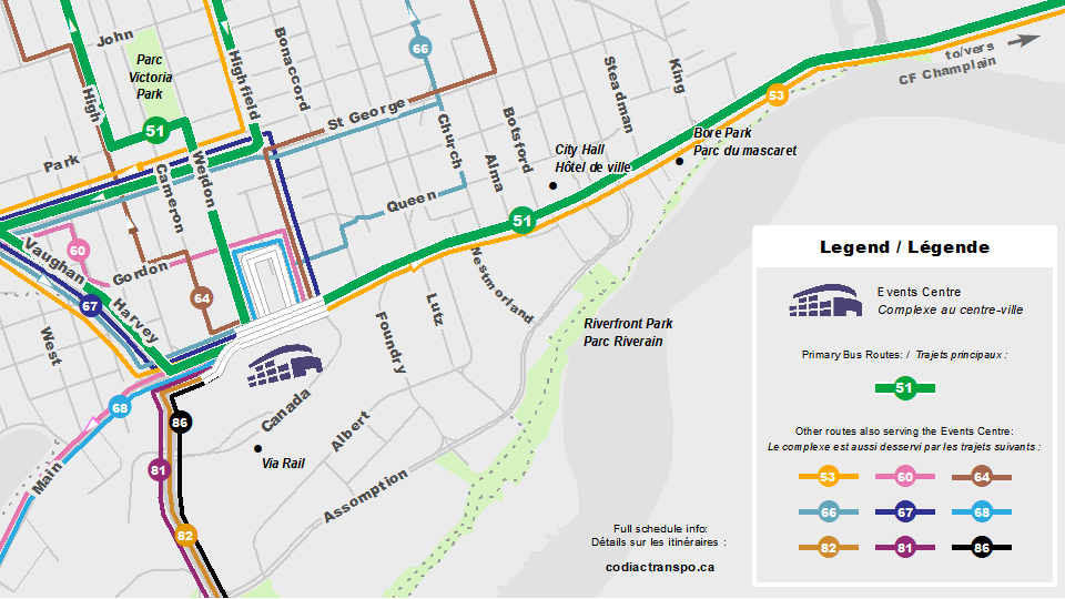
The Green Line (Route 51) runs from CF Champlain to the Northwest Centre with a stop directly in front of the Avenir Centre. The bus runs approximately every 15 minutes. The Green Line also connects with other routes across the city.
Visit the schedules and routes page or use the Codiac Transpo app to plan your trip. If you need additional assistance, you can also contact Codiac Transpo weekdays from 8:30 a.m. to 4:30 p.m. at 506-857-2008.

Bicycle
Cycling routes are available throughout the city including from Riverfront Trail, Vaughan Harvey Boulevard, Gordon Street, Queen Street, High Street, Archibald Street, and Church Street. If travelling down any of these routes, follow the Events Centre signage to get to the Avenir Centre. There are approximately 50 bicycle parking spots located in the outdoor Plaza site.
Downtown Moncton
Accessible options
Capitol Theatre: The nearest accessible parking spaces can be found in the lot at the Marché Moncton Market on Westmorland Street. Patrons with mobility issues can also be dropped off directly in front of the Theatre.
Marché Moncton Market: There are a number of accessible parking spots in the Market parking lot on Westmorland Street. Patrons with mobility issues can also be dropped off at the Market.
City Hall: The nearest accessible parking spaces can be found in the lot at the lot behind City Hall (accessed from Orange Lane).
Riverfront Park: Passengers can be dropped off on Assomption Boulevard.
Hal Betts Commemorative Sportsplex: There is free parking in the lot for the sportsplex on Assomption Boulevard.
Codiac Transpo: Codiac Transpo has nine wheelchair-accessible routes serving Moncton (#16, #50, #51, #60, #61, #62, #64, #65, #93). Buses along designated wheelchair-accessible routes are either equipped with one or two wheelchair spaces. Find out more about wheelchair-accessible transit on Codiac Transpo’s website and visit the schedules and routes page or use the Codiac Transpo app to plan your trip. If you need additional assistance, you can also contact Codiac Transpo weekdays from 8:30 a.m. to 4:30 p.m. at 506-857-2008.
Ability Transit: Wheelchair-accessible buses are available to citizens in the Greater Moncton area. Each bus is equipped with hydraulic lifts and tie-downs for passengers in wheelchairs, plus room for four seated passengers. Contact 506-853-3055 to book a trip.
Park and walk
Visit the parking map to see where to find metered on-street parking and City-owned parking lots. There are also privately owned lots that offer event parking. Visit the Downtown Moncton Centre-Ville Inc. site for a list of privately owned lots.
On-street parking is free on weekends and holidays and after 6 p.m. on weeknights. Parking lots charge various fees for entry. City-owned parking lots have a flat fee of $3 between 6 p.m. and 6 a.m.
Capitol Theatre: The closest on-street parking locations are on Main and Church Streets. The closest paid parking spaces are in the lot behind the Capitol on Seymour Street (accessed from Queen Street), the parking garage (accessed from Alma or Church Streets), and the Marché Moncton Market on Westmorland Street.
Marché Moncton Market: The closest on-street parking locations are on Main and Church Streets. The closest city parking lots are at the Market on Westmorland Street, behind the Capitol Theatre (accessed from Queen Street), and the parking garage (accessed from Alma or Church Streets). Parking in these lots is free on weekends until 6 p.m.
City Hall: The closest on-street parking locations are on Botsford Street. The closest paid parking spaces are in the lot behind City Hall (accessed from Orange Lane), behind the Delta Hotel (access from Main Street), and the parking garage (accessed from Alma or Church Streets).
Riverfront Park: There is on-street parking on Assomption Boulevard and streets north of Assomption. The closest paid parking lot is the private lot behind the Delta Hotel (accessed from Westmorland Street.)
Hal Betts Commemorative Sportsplex: There is free parking in the lot for the sportsplex on Assomption Boulevard.
Car and taxi drop-off
Capitol Theatre: There are designated drop-off spots on Main Street in front of the Theatre.
Marché Moncton Market: Patrons can be dropped off in front of the Market.
City Hall: Visitors can be dropped off on Botsford Street.
Riverfront Park: Visitors can be dropped off on Assomption Boulevard.
Hal Betts Commemorative Sportsplex: Visitors can be dropped off in the parking lot at the sportsplex.
Bus
The Green Line (Route 51) runs from CF Champlain to the Northwest Centre with a stop all along Main Street. The bus runs approximately every 15 minutes. The Green Line also connects with other routes across the city.
Visit the schedules and routes page or use the Codiac Transpo app to plan your trip. If you need additional assistance, you can also contact Codiac Transpo weekdays from 8:30 a.m. to 4:30 p.m. at 506-857-2008.

Bicycle
Cycling routes are available throughout the city including from Riverfront Trail, Vaughan Harvey Boulevard, Gordon Street, Queen Street, High Street, Archibald Street, and Church Street. There are bike racks located throughout the downtown.
Magnetic Hill Zoo and Park
Accessible options
Accessible parking and drop-off: There are free accessible parking spots and drop-off locations throughout the Magnetic Hill Zoo and Park.
Codiac Transpo: Codiac Transpo has nine wheelchair-accessible routes serving Moncton (#16, #50, #51, #60, #61, #62, #64, #65, #93). The #62 serves Magnetic Hill and connects with other routes at the North Plaza.
Buses along designated wheelchair-accessible routes are either equipped with one or two wheelchair spaces. Find out more about wheelchair-accessible transit on Codiac Transpo’s website and visit the schedules and routes page or use the Codiac Transpo app to plan your trip. If you need additional assistance, you can also contact Codiac Transpo weekdays from 8:30 a.m. to 4:30 p.m. at 506-857-2008.
Ability Transit: Wheelchair-accessible buses are available to citizens in the Greater Moncton area. Each bus is equipped with hydraulic lifts and tie-downs for passengers in wheelchairs, plus room for four seated passengers. Contact 506-853-3055 to book a trip.
Park and walk
Free parking is available throughout the Magnetic Hill Zoo and Park site.
Car and taxi drop-off
There are designated drop-off spots throughout the Magnetic Hill Zoo and Park site.
Bus
The #62 runs approximately every 30 minutes and serves Magnetic Hill. It connects with other routes at the North Plaza.
Visit the schedules and routes page or use the Codiac Transpo app to plan your trip. If you need additional assistance, you can also contact Codiac Transpo weekdays from 8:30 a.m. to 4:30 p.m. at 506-857-2008.
Bicycle
Cycling routes are available throughout the city. You can also consult trail maps to find the best route from your location. The Northwest Trail connects to Charles Lutes Road a short distance from Magnetic Hill. There are bike racks located throughout the Magnetic Hill Zoo and Park site.

